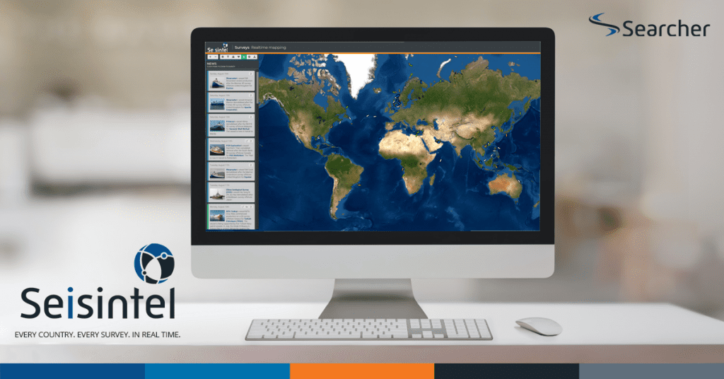
Seisintel is a web portal product which provides live and historic survey information and vessel usage information for the marine survey industry. Seisintel derives this information from Automated Identification System (AIS) data loads and manual database population of survey and client details. Our primary focus is the marine seismic streamer and marine OBN seismic vessel market.

What is Seisintel?

Seisintel captures 2D & 3D seismic projects being acquired and allows survey navigation to stream directly from vessels to your desktop, in real-time! Seisintel also has the capability to be incorporated into any existing GIS system.

The Seisintel database is rich with information that can be mined to analyse the status and performance of the global seismic fleet. Included in a Seisintel subscription is access to a range of standard reports and our dedicated team can also quickly create custom solutions to analyse almost any detail.

Captures every 2D & 3D survey
acquired globally.
Navigation streams directly
to your desktop in real-time.
Compatible with any GIS system.

Plan, track and review your surveys

Seisintel, with a click of a button, exports data that is critical for survey planning, industry activity monitoring, competitor awareness and project
compliance.

With Seisintel, you can search for current and historic surveys, providing you with a wealth of useful project planning data. Real-time vessel positioning information is at your fingertips, with dynamically updating reports and statistics to track and review any survey.

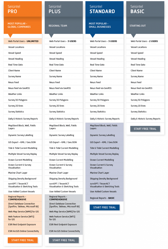
Subscription Options

We have something for everyone.

Whether you’re a small business looking for fast and reliable seismic survey information to improve your business or a large explorer or government with multiple users across the globe wanting to integrate with your GIS systems.