First-of-its-Kind Offshore Seismic Data Now Available for Equatorial Guinea
20.03.2026
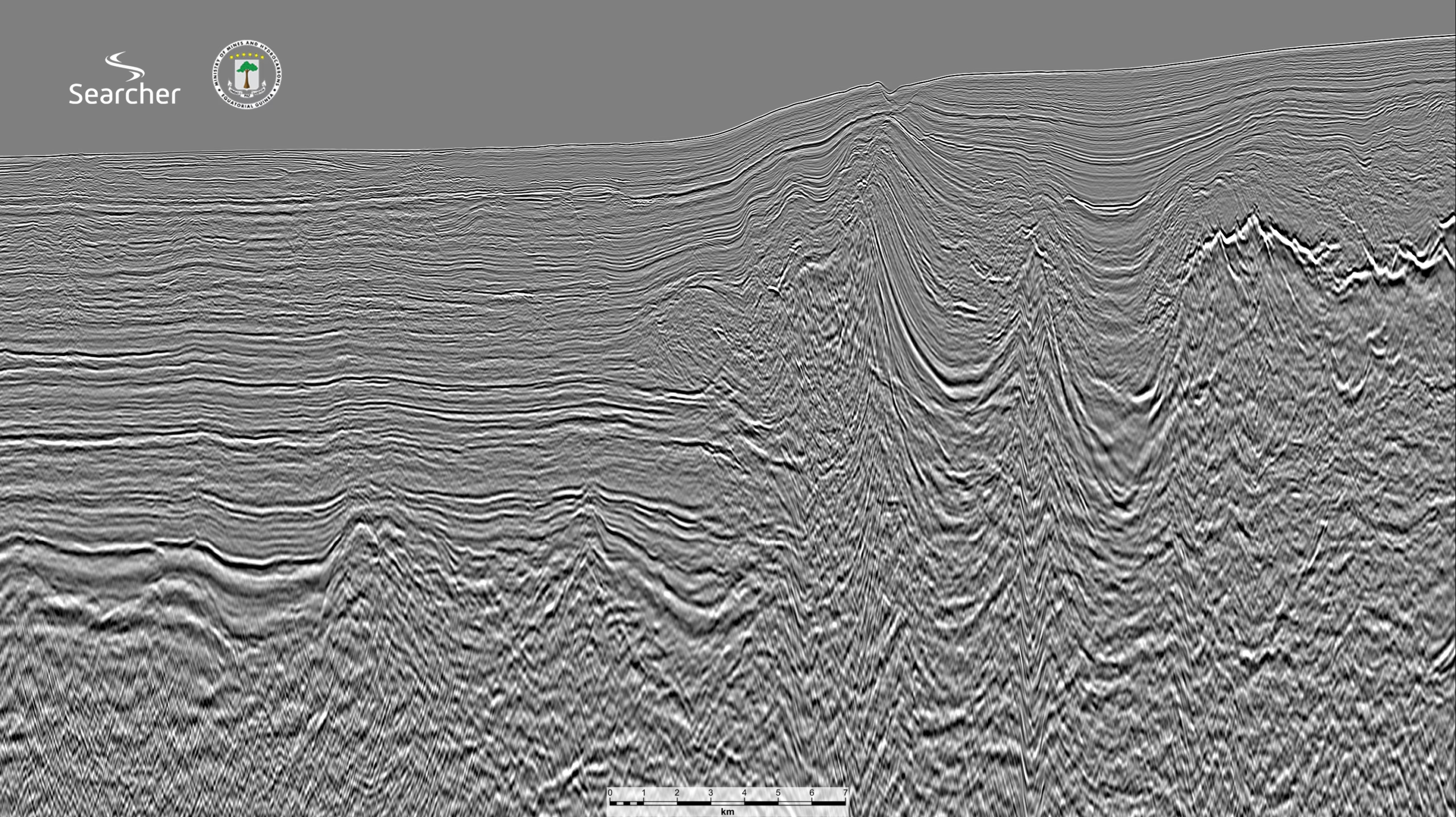
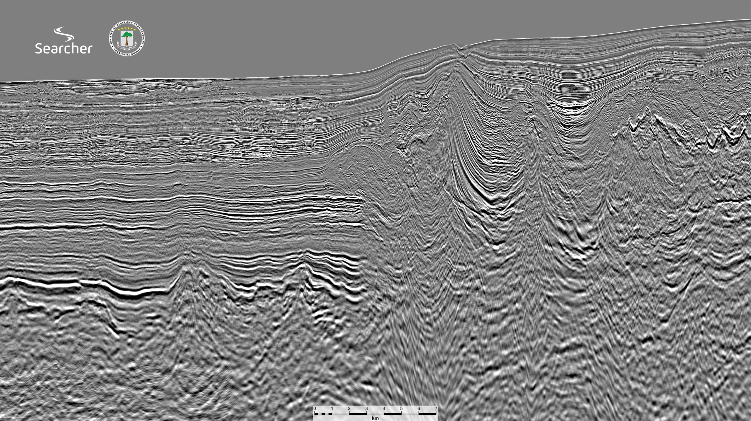
Searcher is pleased to announce the completion of a landmark seismic reprocessing project in Equatorial Guinea, delivering 7,337 km of high-resolution offshore data now available to the industry. Developed in close cooperation with the Equatorial Guinea government’s Ministry of Mines and Hydrocarbons, this dataset is the first of its kind and sets a new standard, providing unprecedented clarity into the nation’s promising offshore basins.
This milestone project transforms legacy datasets using the latest broadband Pre-Stack Depth Migration (PSDM) and Full Waveform Inversion (FWI) technologies. The result is exceptional clarity and detail in imaging complex geological structures, allowing companies clearer insights into hydrocarbon systems and potential reservoirs. This enhanced imaging will help reduce exploration uncertainty, support strategic planning, and pinpoint the most promising prospects ahead of the EG Ronda 2026 licensing round, scheduled to open in April 2026.
“As the first project of its kind in this region, the clarity and resolution now available will fundamentally change how companies approach Equatorial Guinea’s offshore exploration,” said Alan Hopping, Searcher’s Managing Director. “Our close cooperation with the Ministry of Mines and Hydrocarbons was key to delivering a resource that supports the country’s ambitions and empowers the industry to unlock new opportunities.”
This project delivers actionable insights that will help de-risk exploration efforts and support the Ministry of Mines and Hydrocarbons in its mission to revitalise Equatorial Guinea’s energy sector, paving the way for a new wave of investment and discovery.
For more information about this data and how it can support your evaluation for EG Ronda 2026, contact our team and explore new opportunities in West Africa’s offshore domain.