Searcher, a leading provider of global multi-client geoscience data, is pleased to announce the release of its East Coast India Rectified and Reprocessed 2D Dataset following the announcement of the India Offshore Bid Round OALP9 2022/3.
The Offshore India License Round includes 9 blocks East of India in the Krishna Godavari, Mahanadi and Bengal Basins. These blocks are in both shallow and deep water and largely or completely unexplored with incredible potential.
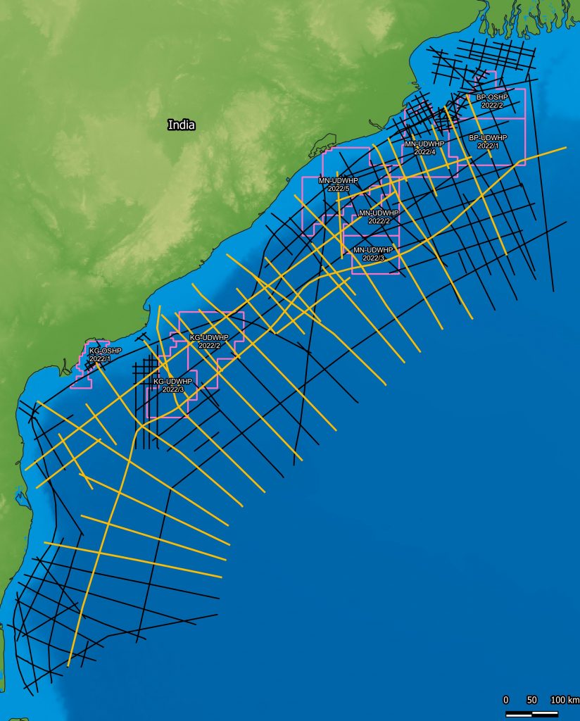
To support the OALP9 License Round, Searcher has released its East Coast India Rectified 2D project which consists of 28,000 km of seismic data. Searcher has applied its proprietary post-stack reprocessing method which rectifies navigation, metadata, amplitude, phase and time to create a regional dataset that allows for an extremely cost-effective ranking of the acreage.
To complement the rectified 2D data Searcher has reprocessed a 9,650 km subset of this data through a 2022 de-ghosting processing sequence to highlight both the source rock AVO and Reservoir sedimentary systems. Reprocessing was undertaken by Shearwater GeoServices.
“The East India 2D Reprocessing and Rectification datasets provide an essential guide to block evaluation, ranking and basin understanding. Early participation of the rectified and reprocessed datasets is designed to be extremely cost effective for any explorer serious about evaluating the East Coast of India License Round,” commented Neil Hodgson, VP Geoscience for Searcher.
The East Coast India 2D datasets are available now for instant streaming and download from the cloud on Searcher’s sAIsmic platform.

East India 2D Reprocessing (orange lines) and East India Rectified 2D Dataset (black lines) located over the OALP9 Round blocks (pink outlines) in East India.
Find Out More
For more information, contact: [email protected]
About Searcher
Searcher is a leading service provider of multi-client geoscience data and products to global oil & gas and mining exploration and production companies. In addition to extensive global geophysical and geological data libraries that include multi-client 2D and 3D seismic data, magnetics and gravity data, geochemical surveys, digital well databases and prospectivity studies, Searcher also offer advanced technological software products. These products include, Seisintel, an online marine survey and vessel tracking software; sAIsmic, a web platform which provides global seismic data on-demand with native support for deep learning; and GeoClerk, a web-based search engine that utilizes machine learning to source industry related imagery.
Follow us on LinkedIn, Facebook & Twitter for the latest project news and updates


